|
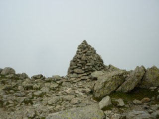
Swirl How
| Height: |
2,630 feet 802 metres |
 |
| Ranking: |
34 |
| Grid Ref: |
SD 273 006 |
| Map: |
South-western Area |
| Book: |
Southern Fells |
| DATE |
WALK |
DISTANCE |
ASCENT |
| Sunday, 19th June 2016 |
Greenburn, Wet Side Edge, Little Carrs, Great Carrs, Swirl How, Levers Hawse, Levers Water, Coppermine Valley, Yewdale |
10.5 mls |
3,600 ft |
|
Sunday, 12th January 2014 |
Dow Bank, Grasmere, Easedale Tarn, Swirl
How |
11.5 mls |
3,140 ft |
|
Sunday, 4th September
2011 |
Tilberthwaite Gill, Coppermines Valley,
Levers Water, Gill Cove, Swirl How,
Great Carrs, Wet Side Edge, Little Langdale, High Tilberthwaite |
11.25 mls |
3,400 ft |
|
Sunday, 15th August 2010 |
Walna Scar Road, Coppermines Valley, Red
Dell Valley, Wetherlam, Swirl How,
Great Carrs,
Grey Friar, Levers Hawse,
Brim Fell,
Coniston Old Man, Goat's
Water, Walna Scar Road |
11.5 mls |
3,665 feet |
|
Wednesday, 23rd June 2010 |
Coppermines Valley, Red Dell,
Wetherlam, Swirl How,
Great Carrs,
Grey Friar,
Brim Fell, Goats Water, Walna Scar Road |
11 mls |
3,540 ft |
|
Sunday, 14th September 2008 |
Walna Scar Road, Low Water,
Brim Fell, Grey
Friar, Great Carrs, Swirl How,
Wetherlam, Copper Mines Valley |
10.6 mls |
3,470 ft |
|
Sunday, 18th May 2008 |
Hodge Close,
Wetherlam Edge, Wetherlam, Swirl How,
Great Carrs, Wet Side Edge, Little
Langdale, Hodge Close |
10 mls |
3,400 ft |
| Wednesday, 29th August
2007 |
Walna Scar Road,
Brim Fell, Swirl How,
Great Carrs, Swirl How,
Wetherlam, Furness Fells, Miners Bridge, Walna Scar Road |
9 miles |
3,400 feet |
| Wednesday, 19th April 2006 |
Walna Scar Road, Brown Pike, Dow Crag, Goat's Hawse, Coniston Old Man,
Brim Fell,
Swirl How, Swirl Hawse, Levers Water, Walna Scar Road |
9.5 miles |
3,300 feet |
Return to Wainwrights List
|